
Thank you for supporting this site ❤️
Make a donation
Make a donation
Milton topographic map
Click on the map to display elevation.
Thank you for supporting this site ❤️
Make a donation
Make a donation
About this map
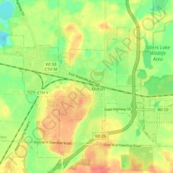
Name: Milton topographic map, elevation, terrain.
Location: Milton, Rock County, Wisconsin, 53563, United States (42.75767 -88.97868 42.79446 -88.90602)
Average elevation: 271 m
Minimum elevation: 246 m
Maximum elevation: 294 m
Thank you for supporting this site ❤️
Make a donation
Make a donation
Other topographic maps
Click on a map to view its topography, its elevation and its terrain.