
Gisagara topographic map
Interactive map
Click on the map to display elevation.
About this map
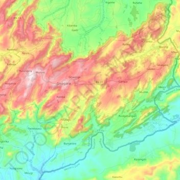
Name: Gisagara topographic map, elevation, terrain.
Location: Gisagara, Cankuzo, Burundi (-3.32212 30.60930 -3.10145 30.84752)
Average elevation: 1,509 m
Minimum elevation: 1,244 m
Maximum elevation: 1,920 m