
Kabaka topographic map
Interactive map
Click on the map to display elevation.
About this map
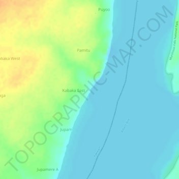
Name: Kabaka topographic map, elevation, terrain.
Location: Kabaka, Nebbi, Northern Region, Uganda (2.37400 31.46738 2.37410 31.46748)
Average elevation: 626 m
Minimum elevation: 614 m
Maximum elevation: 649 m
Other topographic maps
Click on a map to view its topography, its elevation and its terrain.