
Long Island topographic map
Interactive map
Click on the map to display elevation.
About this map
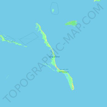
Name: Long Island topographic map, elevation, terrain.
Location: Long Island, Bahamas (22.65100 -75.62203 23.96066 -74.61007)
Average elevation: 0 m
Minimum elevation: -1 m
Maximum elevation: 43 m
Other topographic maps
Click on a map to view its topography, its elevation and its terrain.
Little Whale Clay
Little Whale Clay, Berry Islands, Bahamas
Average elevation: 0 m
Big Whale Cay
Big Whale Cay, West Grand Bahama, Bahamas
Average elevation: 0 m
Paradise Island
Paradise Island, Nassau, New Providence, Bahamas
Average elevation: 3 m
Little Whale Cay
Little Whale Cay, West Grand Bahama, Bahamas
Average elevation: 0 m
Cupid's Cay
Bahamas > Central Eleuthera > Cupid's Cay
Cupid's Cay, Central Eleuthera, Bahamas
Average elevation: 6 m
Current Island
Current Island, North Eleuthera, Bahamas
Average elevation: 0 m