Geolocate

Glan topographic map

Click on the map to display elevation.

About this map

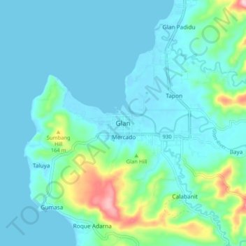
Name: Glan topographic map, elevation, terrain.

Location: Glan, Sarangani, Philippines (5.78257 125.16473 5.86257 125.24473)

Average elevation: 45 m

Minimum elevation: -4 m

Maximum elevation: 289 m

Other topographic maps

Click on a map to view its topography, its elevation and its terrain.

Mainit River

Philippines > Sarangani

Average elevation: 279 m

Malungon

Philippines > Sarangani

Average elevation: 464 m

Glan River

Philippines > Sarangani

Average elevation: 384 m

Sarangani Bay

Philippines > Sarangani

Average elevation: 103 m

Buayan River

Philippines > Sarangani > Malungon

Average elevation: 149 m

Gumasa Beach

Philippines > Sarangani > Glan

Average elevation: 60 m

Malungon

Philippines > Sarangani

Average elevation: 464 m