
Raymond topographic map
Interactive map
Click on the map to display elevation.
About this map
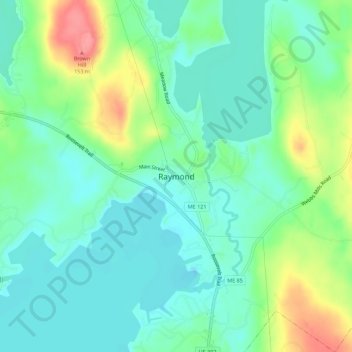
Name: Raymond topographic map, elevation, terrain.
Location: Raymond, Cumberland County, Maine, 04071, USA (43.88185 -70.49043 43.92185 -70.45043)
Average elevation: 98 m
Minimum elevation: 74 m
Maximum elevation: 155 m