
Páramo La Negra topographic map
Interactive map
Click on the map to display elevation.
About this map
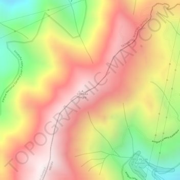
Name: Páramo La Negra topographic map, elevation, terrain.
Average elevation: 3,070 m
Minimum elevation: 2,500 m
Maximum elevation: 3,455 m
Other topographic maps
Click on a map to view its topography, its elevation and its terrain.
La Grita
Venezuela > Estado Táchira > Municipio Jáuregui
La Grita, Parroquia Jáuregui, Municipio Jáuregui, Estado Táchira, Venezuela
Average elevation: 2,076 m