
Hohenzell topographic map
Interactive map
Click on the map to display elevation.
About this map
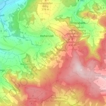
Name: Hohenzell topographic map, elevation, terrain.
Location: Hohenzell, Schlüchtern, Main-Kinzig-Kreis, Hessen, Deutschland (50.29185 9.50390 50.33655 9.56556)
Average elevation: 356 m
Minimum elevation: 191 m
Maximum elevation: 504 m