
Thank you for supporting this site ❤️
Make a donation
Make a donation
Bunker Hill topographic map
Click on the map to display elevation.
Thank you for supporting this site ❤️
Make a donation
Make a donation
About this map
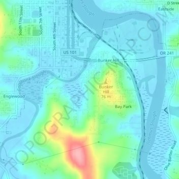
Name: Bunker Hill topographic map, elevation, terrain.
Location: Bunker Hill, Coos County, Oregon, United States (43.33996 -124.22884 43.36309 -124.19380)
Average elevation: 20 m
Minimum elevation: -4 m
Maximum elevation: 118 m
Thank you for supporting this site ❤️
Make a donation
Make a donation
Other topographic maps
Click on a map to view its topography, its elevation and its terrain.