
Bideford topographic map
Interactive map
Click on the map to display elevation.
About this map
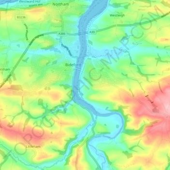
Name: Bideford topographic map, elevation, terrain.
Location: Bideford, Torridge, Devon, Angleterre, Royaume-Uni (50.99321 -4.24819 51.02823 -4.15012)
Average elevation: 54 m
Minimum elevation: -3 m
Maximum elevation: 139 m
Other topographic maps
Click on a map to view its topography, its elevation and its terrain.
Croyden Cross
Royaume-Uni > Angleterre > Devon > Torridge > Thornbury > Gratton
Croyden Cross, Gratton, Milton Damerel, Thornbury, Torridge, Devon, South West England, Angleterre, EX22 7AU, Royaume-Uni
Average elevation: 130 m