
Thank you for supporting this site ❤️
Make a donation
Make a donation
Karangsambung topographic map
Click on the map to display elevation.
Thank you for supporting this site ❤️
Make a donation
Make a donation
About this map
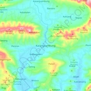
Name: Karangsambung topographic map, elevation, terrain.
Location: Karangsambung, Kebumen, Central Java, Java, 54353, Indonesia (-7.62594 109.63564 -7.54594 109.71564)
Average elevation: 114 m
Minimum elevation: 23 m
Maximum elevation: 394 m
Thank you for supporting this site ❤️
Make a donation
Make a donation