
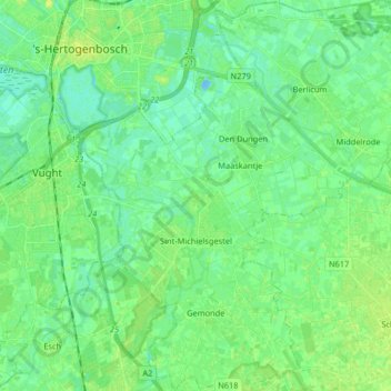
Sint-Michielsgestel topographic map
Interactive map
Click on the map to display elevation.
About this map
Name: Sint-Michielsgestel topographic map, elevation, terrain.
Location: Sint-Michielsgestel, North Brabant, Netherlands (51.60022 5.30380 51.70150 5.45687)
Average elevation: 6 m
Minimum elevation: -11 m
Maximum elevation: 15 m
Other topographic maps
Click on a map to view its topography, its elevation and its terrain.
Geldrop
Geldrop, Geldrop-Mierlo, North Brabant, Netherlands
Average elevation: 21 m
Berkhoek
Netherlands > North Brabant > Udenhout
Berkhoek, Udenhout, Tilburg, North Brabant, Netherlands, 5071 NE, Netherlands
Average elevation: 11 m
Maaskantje
Maaskantje, Sint-Michielsgestel, North Brabant, Netherlands, 5271 XG, Netherlands
Average elevation: 6 m
Gilze
Gilze, Gilze en Rijen, North Brabant, Netherlands
Average elevation: 15 m
Everland
Netherlands > North Brabant > Nispen
Everland, Nispen, Roosendaal, North Brabant, Netherlands, 4709 RM, Netherlands
Average elevation: 8 m
Willemstad
Willemstad, Moerdijk, North Brabant, Netherlands
Average elevation: 0 m
Kloostereind
Netherlands > North Brabant > Helmond
Kloostereind, Helmond, North Brabant, Netherlands, 5704 BK, Netherlands
Average elevation: 21 m
Boxmeer
Boxmeer, Land van Cuijk, North Brabant, Netherlands
Average elevation: 14 m
Terheijden
Netherlands > North Brabant > Terheijden
Terheijden, Drimmelen, North Brabant, Netherlands
Average elevation: 1 m
Eethen
Netherlands > North Brabant > Eethen
Eethen, Altena, North Brabant, Netherlands
Average elevation: 1 m
Eindhoven
Netherlands > North Brabant > Eindhoven
Eindhoven, North Brabant, Netherlands, 5611EB, Netherlands
Average elevation: 21 m
Eind
Netherlands > North Brabant > Riethoven
Eind, Riethoven, Bergeijk, North Brabant, Netherlands, 5561 BC, Netherlands
Average elevation: 27 m
Werveld
Netherlands > North Brabant > Oeffelt > Oeffelt > Werveld
Werveld, Oeffelt, Land van Cuijk, North Brabant, Netherlands, 5441, Netherlands
Average elevation: 12 m
Dommelen
Netherlands > North Brabant > Valkenswaard > Dommelen
Dommelen, Valkenswaard, North Brabant, Netherlands, 5551DE, Netherlands
Average elevation: 25 m
Wanroij
Netherlands > North Brabant > Wanroij > Wanroij
Wanroij, Land van Cuijk, North Brabant, Netherlands, 5446, Netherlands
Average elevation: 15 m
Eerde
Netherlands > North Brabant > Veghel > Eerde
Eerde, Veghel, Meierijstad, North Brabant, Netherlands, 5466, Netherlands
Average elevation: 11 m
Langenboom
Netherlands > North Brabant > Langenboom > Langenboom
Langenboom, Land van Cuijk, North Brabant, Netherlands, 5453, Netherlands
Average elevation: 18 m
Ulvenhout
Ulvenhout, Breda, North Brabant, Netherlands
Average elevation: 6 m
Tilburg
Netherlands > North Brabant > Tilburg
Tilburg, North Brabant, Netherlands
Average elevation: 12 m
Dassemus
Netherlands > North Brabant > Chaam
Dassemus, Chaam, Alphen-Chaam, North Brabant, Netherlands, 4861 TG, Netherlands
Average elevation: 11 m
Middelbeers
Middelbeers, Oost West en Middelbeers, Oirschot, North Brabant, Netherlands, 5091 CB, Netherlands
Average elevation: 19 m
Bergen op Zoom
Bergen op Zoom, North Brabant, Netherlands
Average elevation: 5 m
Sint-Oedenrode
Netherlands > North Brabant > Meierijstad
Sint-Oedenrode, Meierijstad, North Brabant, Netherlands
Average elevation: 12 m
Drunen
Netherlands > North Brabant > Heusden
Drunen, Heusden, North Brabant, Netherlands
Average elevation: 6 m
's-Hertogenbosch
's-Hertogenbosch, North Brabant, Netherlands
Average elevation: 4 m
Doeveren
Netherlands > North Brabant > Heusden
Doeveren, Heusden, North Brabant, Netherlands
Average elevation: 1 m
Veldhoven
Netherlands > North Brabant > Veldhoven
Veldhoven, Eersel, North Brabant, Netherlands
Average elevation: 23 m
Heusden
Netherlands > North Brabant > Heusden
Heusden, North Brabant, Netherlands
Average elevation: 4 m
Valkenswaard
Valkenswaard, North Brabant, Netherlands
Average elevation: 29 m
Sleeuwijk
Netherlands > North Brabant > Altena
Sleeuwijk, Altena, North Brabant, Netherlands
Average elevation: 1 m
Landerd
Netherlands > North Brabant > Landerd
Landerd, North Brabant, Netherlands
Average elevation: 16 m
Mill
Mill, Land van Cuijk, North Brabant, Netherlands
Average elevation: 14 m