
Thank you for supporting this site ❤️
Make a donation
Make a donation
Sungai Rotan topographic map
Click on the map to display elevation.
Thank you for supporting this site ❤️
Make a donation
Make a donation
About this map
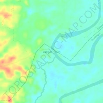
Name: Sungai Rotan topographic map, elevation, terrain.
Location: Sungai Rotan, Sarolangun, Jambi, Sumatra, Indonesia (-1.97399 102.93818 -1.93399 102.97818)
Average elevation: 33 m
Minimum elevation: 18 m
Maximum elevation: 68 m
Thank you for supporting this site ❤️
Make a donation
Make a donation
Other topographic maps
Click on a map to view its topography, its elevation and its terrain.