
Thank you for supporting this site ❤️
Make a donation
Make a donation
Bourron topographic map
Click on the map to display elevation.
Thank you for supporting this site ❤️
Make a donation
Make a donation
About this map
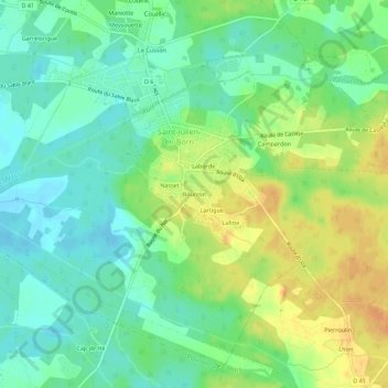
Name: Bourron topographic map, elevation, terrain.
Average elevation: 17 m
Minimum elevation: 2 m
Maximum elevation: 36 m
Thank you for supporting this site ❤️
Make a donation
Make a donation
Other topographic maps
Click on a map to view its topography, its elevation and its terrain.
Phare de Contis
France > Nouvelle-Aquitaine > Landes > Saint-Julien-en-Born > Contis-Plage
Average elevation: 9 m