
Bridgetown topographic map
Interactive map
Click on the map to display elevation.
About this map
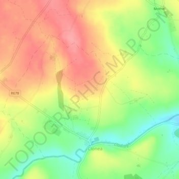
Name: Bridgetown topographic map, elevation, terrain.
Average elevation: 89 m
Minimum elevation: 43 m
Maximum elevation: 128 m
Other topographic maps
Click on a map to view its topography, its elevation and its terrain.
Dunmore East
Dunmore East, County Waterford, Munster, X91 C677, Irland
Average elevation: 36 m
Waterford
Waterford, County Waterford, Munster, Irland
Average elevation: 33 m