
Saalfeld/Saale topographic map
Interactive map
Click on the map to display elevation.
About this map
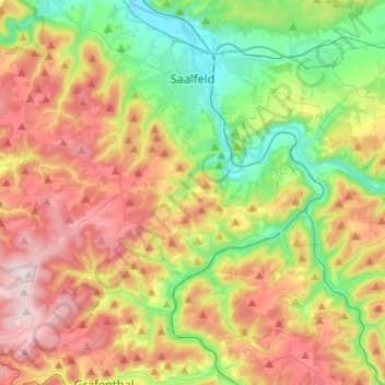
Name: Saalfeld/Saale topographic map, elevation, terrain.
Average elevation: 441 m
Minimum elevation: 200 m
Maximum elevation: 764 m
Other topographic maps
Click on a map to view its topography, its elevation and its terrain.
Meura
Alemanha > Turíngia > Landkreis Saalfeld-Rudolstadt > Meura
Meura, Schwarzatal, Landkreis Saalfeld-Rudolstadt, Turíngia, Alemanha
Average elevation: 585 m