
Thank you for supporting this site ❤️
Make a donation
Make a donation
Ferretti topographic map
Click on the map to display elevation.
Thank you for supporting this site ❤️
Make a donation
Make a donation
About this map
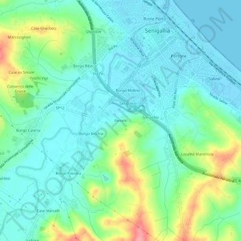
Name: Ferretti topographic map, elevation, terrain.
Location: Ferretti, Senigallia, Ancona, Marche, 60019, Italia (43.67998 13.18952 43.71998 13.22952)
Average elevation: 32 m
Minimum elevation: -2 m
Maximum elevation: 122 m
Thank you for supporting this site ❤️
Make a donation
Make a donation