
Kirchdorf topographic map
Interactive map
Click on the map to display elevation.
About this map
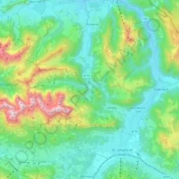
Name: Kirchdorf topographic map, elevation, terrain.
Average elevation: 1,009 m
Minimum elevation: 599 m
Maximum elevation: 2,312 m
Other topographic maps
Click on a map to view its topography, its elevation and its terrain.
Habach
Oostenrijk > Tirol > Bezirk Kitzbühel > Gemeinde Kirchdorf in Tirol
Habach, Kirchdorf, Gemeinde Kirchdorf in Tirol, Bezirk Kitzbühel, Tirol, 6382, Oostenrijk
Average elevation: 804 m
Erpfendorf
Oostenrijk > Tirol > Bezirk Kitzbühel > Gemeinde Kirchdorf in Tirol
Erpfendorf, Gemeinde Kirchdorf in Tirol, Bezirk Kitzbühel, Tirol, 6383, Oostenrijk
Average elevation: 1,014 m