
Thank you for supporting this site ❤️
Make a donation
Make a donation
Loyal topographic map
Click on the map to display elevation.
Thank you for supporting this site ❤️
Make a donation
Make a donation
About this map
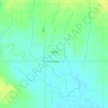
Name: Loyal topographic map, elevation, terrain.
Location: Loyal, Kingfisher County, Oklahoma, United States (35.97083 -98.12179 35.97471 -98.11507)
Average elevation: 344 m
Minimum elevation: 337 m
Maximum elevation: 354 m
Thank you for supporting this site ❤️
Make a donation
Make a donation
Other topographic maps
Click on a map to view its topography, its elevation and its terrain.