
Thank you for supporting this site ❤️
Make a donation
Make a donation
Devils Backbone topographic map
Click on the map to display elevation.
Thank you for supporting this site ❤️
Make a donation
Make a donation
About this map
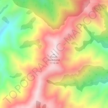
Name: Devils Backbone topographic map, elevation, terrain.
Location: Devils Backbone, Marlborough, New Zealand (-41.66869 173.44939 -41.66859 173.44949)
Average elevation: 806 m
Minimum elevation: 436 m
Maximum elevation: 1,110 m
Thank you for supporting this site ❤️
Make a donation
Make a donation
Other topographic maps
Click on a map to view its topography, its elevation and its terrain.