
Thank you for supporting this site ❤️
Make a donation
Make a donation
Bukhara topographic map
Click on the map to display elevation.
Thank you for supporting this site ❤️
Make a donation
Make a donation
Bukhara
About 140 miles (230 km) west of Samarkand in south-central Uzbekistan, Bukhara is located on the Zeravshan River, at an elevation of 751 feet (229 meters).
Thank you for supporting this site ❤️
Make a donation
Make a donation
About this map
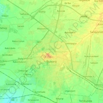
Name: Bukhara topographic map, elevation, terrain.
Location: Bukhara, Bukhara Region, 200100, Uzbekistan (39.72944 64.37685 39.82321 64.47809)
Average elevation: 225 m
Minimum elevation: 216 m
Maximum elevation: 237 m
Thank you for supporting this site ❤️
Make a donation
Make a donation