
Thank you for supporting this site ❤️
Make a donation
Make a donation
Bani Abbas topographic map
Click on the map to display elevation.
Thank you for supporting this site ❤️
Make a donation
Make a donation
About this map
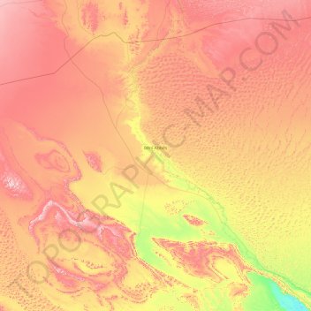
Name: Bani Abbas topographic map, elevation, terrain.
Location: Bani Abbas, Bani Abbas District, Beni Abbes, 08300, Algeria (29.35244 -3.22868 30.81872 -1.31643)
Average elevation: 564 m
Minimum elevation: 289 m
Maximum elevation: 868 m
Thank you for supporting this site ❤️
Make a donation
Make a donation