
Sattelegg topographic map
Interactive map
Click on the map to display elevation.
About this map
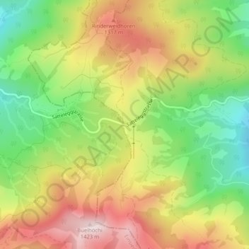
Name: Sattelegg topographic map, elevation, terrain.
Location: Sattelegg, Vorderthal, March, Schwyz, 8857, Schweiz (47.12728 8.84677 47.12738 8.84687)
Average elevation: 1,179 m
Minimum elevation: 967 m
Maximum elevation: 1,405 m
Die Sattelegg ist ein Passübergang im Schweizer Kanton Schwyz. Er befindet sich zwischen den Orten Vorderthal im Bezirk March und Willerzell im Bezirk Einsiedeln, die Passhöhe liegt auf 1190 m ü. M.