
Scottsdale topographic map
Interactive map
Click on the map to display elevation.
About this map
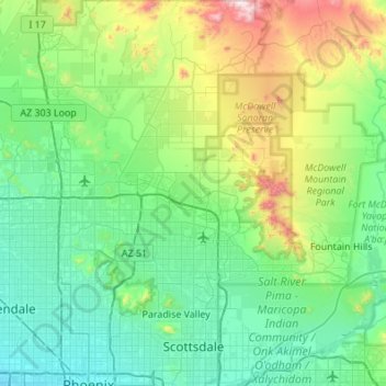
Name: Scottsdale topographic map, elevation, terrain.
Average elevation: 553 m
Minimum elevation: 320 m
Maximum elevation: 1,468 m
Other topographic maps
Click on a map to view its topography, its elevation and its terrain.
Phoenix
Vereinigte Staaten von Amerika > Arizona > Maricopa County
Phoenix, Maricopa County, Arizona, Vereinigte Staaten von Amerika
Average elevation: 481 m