
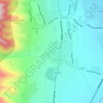
Waikapu topographic map
Interactive map
Click on the map to display elevation.
About this map
Name: Waikapu topographic map, elevation, terrain.
Average elevation: 148 m
Minimum elevation: 25 m
Maximum elevation: 568 m
Other topographic maps
Click on a map to view its topography, its elevation and its terrain.
Maui
Vereinigte Staaten von Amerika > Hawaii > Maui County
Maui, Maui County, Hawaii, Vereinigte Staaten von Amerika
Average elevation: 232 m