
Thank you for supporting this site ❤️
Make a donation
Make a donation
Bear Creek topographic map
Click on the map to display elevation.
Thank you for supporting this site ❤️
Make a donation
Make a donation
About this map
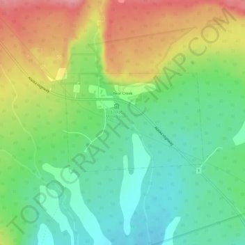
Name: Bear Creek topographic map, elevation, terrain.
Location: Bear Creek, Yukon, Canada (60.78774 -137.68135 60.79871 -137.64994)
Average elevation: 646 m
Minimum elevation: 601 m
Maximum elevation: 713 m
Thank you for supporting this site ❤️
Make a donation
Make a donation