
Chièvres topographic map
Interactive map
Click on the map to display elevation.
About this map
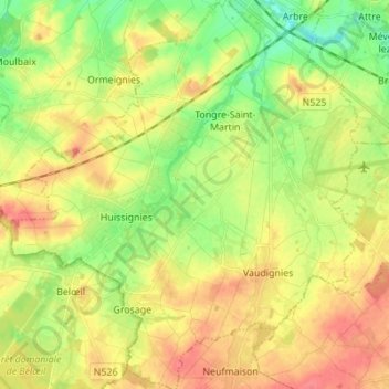
Name: Chièvres topographic map, elevation, terrain.
Location: Chièvres, Ath, Hainaut, Wallonia, Belgium (50.52649 3.71390 50.61378 3.83734)
Average elevation: 59 m
Minimum elevation: 29 m
Maximum elevation: 89 m
Other topographic maps
Click on a map to view its topography, its elevation and its terrain.
Tongre-Notre-Dame
Tongre-Notre-Dame, Chièvres, Ath, Hainaut, Wallonia, 7951, Belgium
Average elevation: 56 m
Frasnes-lez-Anvaing
Frasnes-lez-Anvaing, Ath, Hainaut, Wallonia, Belgium
Average elevation: 56 m