
Kaloha topographic map
Click on the map to display elevation.
About this map
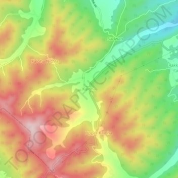
Name: Kaloha topographic map, elevation, terrain.
Location: Kaloha, Rakkar, Kangra, Himachal Pradesh, 177108, India (31.75640 76.20089 31.79640 76.24089)
Average elevation: 732 m
Minimum elevation: 561 m
Maximum elevation: 897 m