
Toledo topographic map
Interactive map
Click on the map to display elevation.
About this map
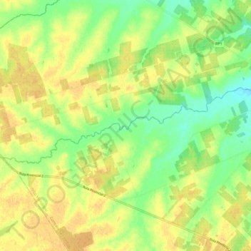
Name: Toledo topographic map, elevation, terrain.
Average elevation: 66 m
Minimum elevation: 49 m
Maximum elevation: 77 m
Other topographic maps
Click on a map to view its topography, its elevation and its terrain.
Toledo
Argentinien > Provinz Entre Ríos > Distrito Mandisoví
Toledo, Junta de Gobierno de La Fraternidad y Santa Juana, Distrito Mandisoví, Departamento Federación, Provinz Entre Ríos, Argentinien
Average elevation: 49 m