
Khamir District topographic map
Interactive map
Click on the map to display elevation.
About this map
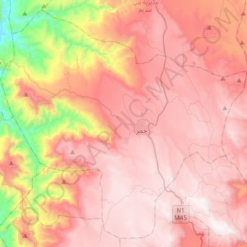
Name: Khamir District topographic map, elevation, terrain.
Location: Khamir District, Amran Governorate, Yemen (15.87352 43.79681 16.11745 44.07062)
Average elevation: 2,162 m
Minimum elevation: 1,046 m
Maximum elevation: 2,767 m
Other topographic maps
Click on a map to view its topography, its elevation and its terrain.
Al Batinah
Yemen > Amran Governorate > Al Batinah
Al Batinah, Amran Governorate, Yemen
Average elevation: 1,285 m