
Thank you for supporting this site ❤️
Make a donation
Make a donation
Pomaria topographic map
Click on the map to display elevation.
Thank you for supporting this site ❤️
Make a donation
Make a donation
About this map
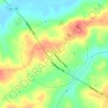
Name: Pomaria topographic map, elevation, terrain.
Location: Pomaria, Newberry County, South Carolina, United States (34.25958 -81.42967 34.27635 -81.40960)
Average elevation: 111 m
Minimum elevation: 84 m
Maximum elevation: 142 m
Thank you for supporting this site ❤️
Make a donation
Make a donation
Other topographic maps
Click on a map to view its topography, its elevation and its terrain.