
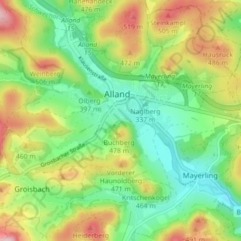
Katastralgemeinde Alland topographic map
Interactive map
Click on the map to display elevation.
About this map
Name: Katastralgemeinde Alland topographic map, elevation, terrain.
Average elevation: 396 m
Minimum elevation: 299 m
Maximum elevation: 549 m
Other topographic maps
Click on a map to view its topography, its elevation and its terrain.
Maria Raisenmarkt
Österreich > Niederösterreich > Bezirk Baden > Gemeinde Alland
Maria Raisenmarkt, Gemeinde Alland, Bezirk Baden, Niederösterreich, 2534, Österreich
Average elevation: 472 m