
Thank you for supporting this site ❤️
Make a donation
Make a donation
Moncan topographic map
Click on the map to display elevation.
Thank you for supporting this site ❤️
Make a donation
Make a donation
About this map
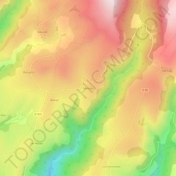
Name: Moncan topographic map, elevation, terrain.
Average elevation: 1,043 m
Minimum elevation: 663 m
Maximum elevation: 1,331 m
Thank you for supporting this site ❤️
Make a donation
Make a donation
Other topographic maps
Click on a map to view its topography, its elevation and its terrain.
Saint-Geniez-d'Olt
France > Occitanie > Aveyron > Saint Geniez d'Olt et d'Aubrac
Average elevation: 614 m
Aurelle-Verlac
France > Occitanie > Aveyron > Saint Geniez d'Olt et d'Aubrac
Average elevation: 1,119 m