
Espern topographic map
Interactive map
Click on the map to display elevation.
About this map
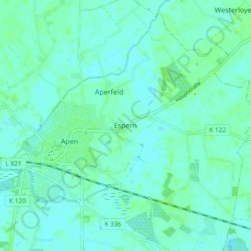
Name: Espern topographic map, elevation, terrain.
Location: Espern, Apen, Landkreis Ammerland, Nedersaksen, 26689, Duitsland (53.20395 7.80463 53.24395 7.84463)
Average elevation: 3 m
Minimum elevation: -2 m
Maximum elevation: 8 m
Other topographic maps
Click on a map to view its topography, its elevation and its terrain.
Nethen
Duitsland > Nedersaksen > Landkreis Ammerland > Rastede
Nethen, Rastede, Landkreis Ammerland, Nedersaksen, 26180, Duitsland
Average elevation: 14 m
Bad Zwischenahn
Duitsland > Nedersaksen > Landkreis Ammerland > Bad Zwischenahn
Bad Zwischenahn, Landkreis Ammerland, Nedersaksen, 26160, Duitsland
Average elevation: 9 m