
Stamford topographic map
Interactive map
Click on the map to display elevation.
About this map
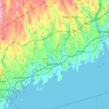
Name: Stamford topographic map, elevation, terrain.
Average elevation: 48 m
Minimum elevation: -1 m
Maximum elevation: 215 m
Other topographic maps
Click on a map to view its topography, its elevation and its terrain.
Westport
Vereinigte Staaten von Amerika > Connecticut > Western Connecticut Planning Region
Westport, Western Connecticut Planning Region, Connecticut, 06880, Vereinigte Staaten von Amerika
Average elevation: 22 m