
Cortaillod topographic map
Interactive map
Click on the map to display elevation.
About this map
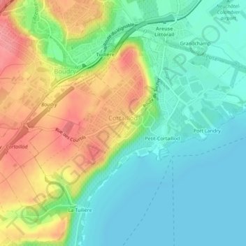
Name: Cortaillod topographic map, elevation, terrain.
Location: Cortaillod, District de Boudry, Neuchâtel, 2016, Svizzera (46.93241 6.82860 46.95283 6.87103)
Average elevation: 455 m
Minimum elevation: 422 m
Maximum elevation: 510 m