
Prauthoy topographic map
Interactive map
Click on the map to display elevation.
About this map
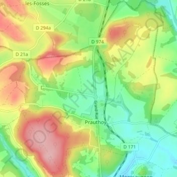
Name: Prauthoy topographic map, elevation, terrain.
Average elevation: 333 m
Minimum elevation: 273 m
Maximum elevation: 411 m
Other topographic maps
Click on a map to view its topography, its elevation and its terrain.
Aubigny-sur-Badin
France > Grand Est > Haute-Marne > Le Montsaugeonnais > Aubigny-sur-Badin
Aubigny-sur-Badin, Le Montsaugeonnais, Langres, Haute-Marne, Grand Est, France métropolitaine, 52190, France
Average elevation: 319 m