
Thank you for supporting this site ❤️
Make a donation
Make a donation
Le Bachas topographic map
Click on the map to display elevation.
Thank you for supporting this site ❤️
Make a donation
Make a donation
About this map
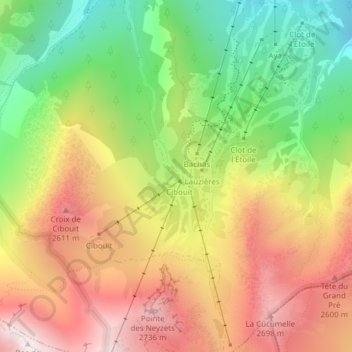
Name: Le Bachas topographic map, elevation, terrain.
Average elevation: 2,207 m
Minimum elevation: 1,628 m
Maximum elevation: 2,796 m
Thank you for supporting this site ❤️
Make a donation
Make a donation
Other topographic maps
Click on a map to view its topography, its elevation and its terrain.
Glacier du Réou d'Arsine
France > Provence-Alpes-Côte d'Azur > Hautes-Alpes > Le Monêtier-les-Bains
Average elevation: 2,806 m
05220
France > Provence-Alpes-Côte d'Azur > Hautes-Alpes > Le Monêtier-les-Bains
Average elevation: 1,847 m
Glacier Supérieur d'Arsine
France > Provence-Alpes-Côte d'Azur > Hautes-Alpes > Le Monêtier-les-Bains
Average elevation: 2,965 m