
Thank you for supporting this site ❤️
Make a donation
Make a donation
Linn County topographic map
Click on the map to display elevation.
Thank you for supporting this site ❤️
Make a donation
Make a donation
About this map
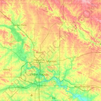
Name: Linn County topographic map, elevation, terrain.
Location: Linn County, Iowa, United States (41.85949 -91.83526 42.29905 -91.36329)
Average elevation: 261 m
Minimum elevation: 207 m
Maximum elevation: 335 m
Thank you for supporting this site ❤️
Make a donation
Make a donation
Other topographic maps
Click on a map to view its topography, its elevation and its terrain.