
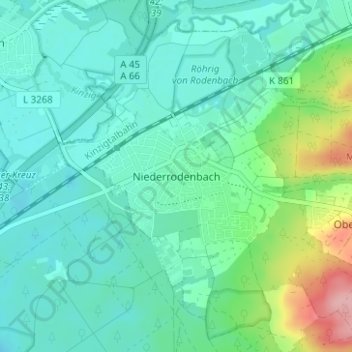
Niederrodenbach topographic map
Interactive map
Click on the map to display elevation.
About this map
Name: Niederrodenbach topographic map, elevation, terrain.
Average elevation: 130 m
Minimum elevation: 102 m
Maximum elevation: 232 m
Niederrodenbach liegt in der Nähe von Hanau, etwa 20 km östlich von Frankfurt am Main am Rande des Vorspessarts auf einer Höhe von ca. 120 m über NN. an der Lache, auch „Rodenbach“ genannt.