
Malegaon Budruk topographic map
Interactive map
Click on the map to display elevation.
About this map
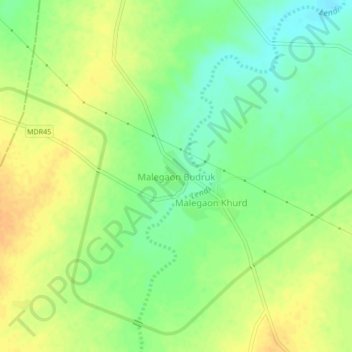
Name: Malegaon Budruk topographic map, elevation, terrain.
Location: Malegaon Budruk, Georai, Beed, Maharashtra, India (19.33157 75.52650 19.37157 75.56650)
Average elevation: 448 m
Minimum elevation: 431 m
Maximum elevation: 463 m
Other topographic maps
Click on a map to view its topography, its elevation and its terrain.
Georai
India > Maharashtra > Georai
Gevrai is located at the coordinates 19°10′N 75°27′E / 19.16°N 75.45°E / 19.16; 75.45, and has an average elevation of 465 metres (1528 feet).
Average elevation: 478 m