
Juneau County topographic map
Click on the map to display elevation.
About this map
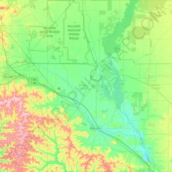
Name: Juneau County topographic map, elevation, terrain.
Location: Juneau County, Wisconsin, United States (43.64070 -90.31282 44.24971 -89.78526)
Average elevation: 302 m
Minimum elevation: 253 m
Maximum elevation: 441 m
Other topographic maps
Click on a map to view its topography, its elevation and its terrain.
Kalahari Indoor Waterpark
United States > Wisconsin > Sauk County > Wisconsin Dells
Average elevation: 290 m