
Gaspalha topographic map
Interactive map
Click on the map to display elevation.
About this map
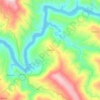
Name: Gaspalha topographic map, elevation, terrain.
Location: Gaspalha, Álvaro, Oleiros, Castelo Branco, 6160-052, Portugal (39.96533 -7.97083 40.00533 -7.93083)
Average elevation: 423 m
Minimum elevation: 268 m
Maximum elevation: 649 m
Other topographic maps
Click on a map to view its topography, its elevation and its terrain.
Frazumeira
Portugal > Castelo Branco > Oleiros > Álvaro
Frazumeira, Álvaro, Oleiros, Castelo Branco, Portugal
Average elevation: 476 m