
Pha Maipo topographic map
Interactive map
Click on the map to display elevation.
About this map
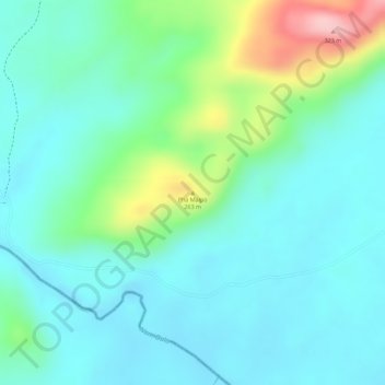
Name: Pha Maipo topographic map, elevation, terrain.
Location: Pha Maipo, ເມືອງເຊບັ້ງໄຟ, Province de Khammouane, Laos (17.11454 105.18267 17.11464 105.18277)
Average elevation: 190 m
Minimum elevation: 144 m
Maximum elevation: 327 m
Other topographic maps
Click on a map to view its topography, its elevation and its terrain.
Ban Xon
Laos > Province de Khammouane > ເມືອງຍົມມະລາດ
Ban Xon, ເມືອງຍົມມະລາດ, Province de Khammouane, Laos
Average elevation: 166 m
ເມືອງຄູນຄຳ
ເມືອງຄູນຄຳ, Province de Khammouane, Laos
Average elevation: 487 m