
Thank you for supporting this site ❤️
Make a donation
Make a donation
Amport topographic map
Click on the map to display elevation.
Thank you for supporting this site ❤️
Make a donation
Make a donation
About this map
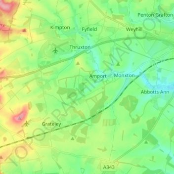
Name: Amport topographic map, elevation, terrain.
Location: Amport, Test Valley, Hampshire, England, United Kingdom (51.16207 -1.67238 51.22366 -1.55082)
Average elevation: 95 m
Minimum elevation: 56 m
Maximum elevation: 176 m
Thank you for supporting this site ❤️
Make a donation
Make a donation
Other topographic maps
Click on a map to view its topography, its elevation and its terrain.