
Thank you for supporting this site ❤️
Make a donation
Make a donation
Chebar topographic map
Click on the map to display elevation.
Thank you for supporting this site ❤️
Make a donation
Make a donation
About this map
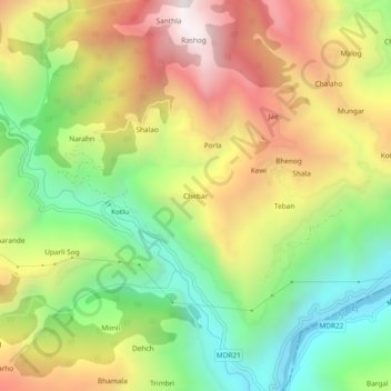
Name: Chebar topographic map, elevation, terrain.
Location: Chebar, Karsog, Mandi, Himachal Pradesh, 172027, India (31.34688 77.32349 31.38688 77.36349)
Average elevation: 1,353 m
Minimum elevation: 734 m
Maximum elevation: 2,092 m
Thank you for supporting this site ❤️
Make a donation
Make a donation
Other topographic maps
Click on a map to view its topography, its elevation and its terrain.