
Alwal topographic map
Interactive map
Click on the map to display elevation.
About this map
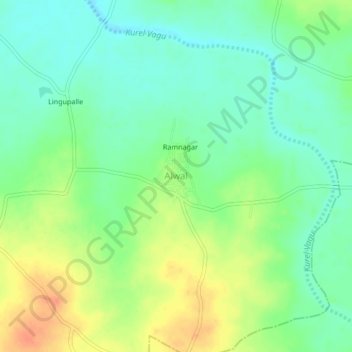
Name: Alwal topographic map, elevation, terrain.
Location: Alwal, Mirdoddi mandal, Siddipet, Telangana, India (18.01929 78.65665 18.05929 78.69665)
Average elevation: 501 m
Minimum elevation: 483 m
Maximum elevation: 528 m