
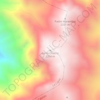
Cerro Chache topographic map
Interactive map
Click on the map to display elevation.
About this map
Name: Cerro Chache topographic map, elevation, terrain.
Average elevation: 1,981 m
Minimum elevation: 1,201 m
Maximum elevation: 2,337 m
Other topographic maps
Click on a map to view its topography, its elevation and its terrain.
Cabildo
Chile > Região de Valparaiso > Provincia de Petorca > Cabildo
Cabildo, Provincia de Petorca, Região de Valparaiso, Chile
Average elevation: 789 m