
El Tanque topographic map
Interactive map
Click on the map to display elevation.
About this map
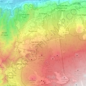
Name: El Tanque topographic map, elevation, terrain.
Location: El Tanque, Santa Cruz de Tenerife, Canárias, 38435, Espanha (28.28663 -16.80889 28.36909 -16.74254)
Average elevation: 959 m
Minimum elevation: 56 m
Maximum elevation: 1,734 m