
Gocheon-dong topographic map
Interactive map
Click on the map to display elevation.
About this map
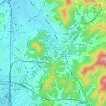
Name: Gocheon-dong topographic map, elevation, terrain.
Location: Gocheon-dong, Uiwang-si, Gyeonggi-do, South Korea (37.32663 126.95823 37.35552 127.01803)
Average elevation: 99 m
Minimum elevation: 38 m
Maximum elevation: 289 m